Tours (France), May 15th, 2017.
Articque will reveal the new major version of Articque MAP at Qonnections
Qonnections is the Worldwide Global Conference for Qlik’s partners and users, which takes place in Orlando (FL) on 15th to the 18th of May.
Articque MAP is the key decisional mapping extension for Qlik Sense® and QlikView® users. Developed by ARTICQUE, the French mapping intelligence solutions editor, it was awarded Qlik’s “EMEA Technology Partner of the Year” during the last Qonnections event.
The new version of Articque MAP enables users to push further the geographical analysis of their data, by proposing several innovations, such as :
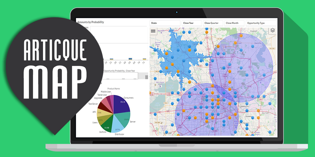
- The “Isochron” functionality, available without additional cost, which allows to display travel time from a point depending on distance (kilometers/miles) or time (minutes) with several modes of transport (car, truck, bike, walk).
- The “Buffer” functionality which allows to draw a “crow-fly” distance a around a point, a line or a polygon.
- The “Personalized proportional symbol” functionality which allows to use personalized vector objects as proportional symbols to represent data values.
- New WMS tiles to change map backgrounds.
- A New interface to simplify entering dimensions and measures in Qlik Sense®.
Meet our team at Qonnections on booth#705 to discover all the new features in detail, but also expect plenty of suprises for clients and resellers!
Learn more about Articque MAP for Qlikview and Qliksense


 DR
DR